The UA STEM program will launch a new project aimed at engaging freshman and sophomore STEM majors in the NROTC and student-veteran programs in the area of geospatial science. The purpose of this project is to show how science can be used in the fields of military and defense systems.
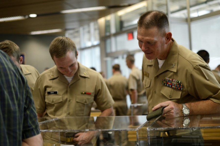
Project NAVIGATE, which stands for Navy Intelligence through Geospatial Applications and Technology, partners the NROTC and student-veteran programs with Raytheon Missile Systems to provide a unique hands-on experience for members of the programs.
The program is receiving $748,000 from the Office of Naval Research and will be at the university for the next three years, beginning on Oct. 13.
NAVIGATE comes from a desire to “increase an interest in STEM in multiple areas, including with non-traditional students, including ROTC and student-vets,” said Dr. Sara Chavarria, the assistant director of the STEM Learning Center and one of the head figures of the project.
Chavarria also explained that many of the professionals in the STEM fields are growing older and are close to retirement, creating a demand for a new, younger generation of individuals who will replace them. The problem is that the number of students in the STEM-related majors has recently decreased while the number of individuals needed in STEM fields grows.
RELATED: UA’s Navy ROTC tours new USS Arizona exhibit
“We see many students get out of STEM after their first year,” Chavarria said. “We want to get students interested in STEM.”
Keeping students enrolled in the program shouldn’t be a challenge though, as they will be given a hands-on experience, real-world applications and information that will be both educational and challenging, said Chavarria.
“The projects the students will do will be military and defense related,” said Alex Ruff, coordinator for the project and an army veteran. “Examples of this include using submarine location systems in the South China Sea or using GIS [global information systems] to determine where an airfield should be built. These examples only scratch the surface.”
Members of the UA faculty will be teaching the real-world applications of geospatial science. Associate professor of geology Willem Van Leeuwen will teach students about using satellite data for “remote sensing” or gathering data on various geographical properties of the Earth. He said that many of the lessons taught in the course are used outside the military as well.
“We are introducing many new techniques and applications,” Van Leeuwen said. “We will be using skills that are used by every sector of society.”
RELATED: USS Arizona mall memorial to open by 75th anniversary of Pearl Harbor
Part of the NAVIGATE program is additional mentoring for enrolled students from a group of student veterans working with the project. This group will provide guidance and real world insight to some of the skills taught in class through prior experience with the systems taught while in service.
There are currently 13 midshipmen enrolled in the program along with four student-veteran mentors, and the numbers are expected to grow as the project develops. According to the NROTC commanding officer Colonel Patrick Wall, the first course will inform midshipmen on the various GIS systems and technology, followed by a second course focused on group projects.
The projects will be presented to a group of geospatial professionals at the Esri Federal GIS Conference held in Washington, D.C. in February next year.
Follow Jordan on Twitter.