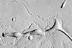
Icy surfaces, craters and troughs – these are just some of the sights on Mars photographed by a team of UA scientists during the past year.
The UA High Resolution Imaging Science Experiment camera receives 10 new images of Mars every day, giving scientists the opportunity to learn more about the planet constantly, said professor Alfred McEwen of the University of Arizona Lunar and Planetary Laboratory, the principal investigator for HiRISE.
The latest images reveal the 1997 landing site of the Mars Pathfinder, in addition to photographs of Big Crater, Twin Peaks and North Knob, all landmarks seen from the surface by the imager for Mars Pathfinder.
As the HiRISE team rounds out its first year, McEwen said the first two years are the most crucial to receive data.
With the resources to take photographs anywhere on Mars, the team will see a staggering 34 terabytes of data returned from the orbiter over that span – enough information to fill 6,500 CDs or 1,000 DVDs, McEwen said.
The HiRISE team mostly studies polar and small areas of Mars, and stark or large areas are not covered, McEwen said.
“”We’ve found that some areas include defrosting of seasonal carbon dioxide that does not just sublimate, it gets trapped under the ice,”” he said.
As well as scouting future landing sites, the pictures will open a door into Mars’ geological past, McEwen said.
“”We want to understand the origins of the features,”” he said. “”We want to resolve boulders that have been transported.””
The $60 million HiRISE is one of three cameras aboard the Mars Reconnaissance Orbiter, which is orbiting Mars at an average altitude of 187.5 miles, said Sue Smrekar, deputy project scientist of the MRO.
From the first picture taken, the MRO had a ground speed of 1.7 kilometers per second, McEwen said.
The MRO and the HiRISE successfully entered Martian orbit March 10.


