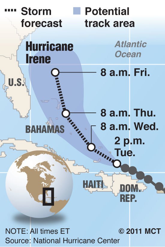
ATLANTA — The latest on Hurricane Irene, from overnight reports: It will likely make landfall in the Carolinas sometime this weekend, moving north and potentially causing major headaches as far north as New England.
Georgia is not as likely to be in Irene’s crosshairs, according to an online report from AccuWeather.com, which is great news for Georgians — unless you happen to be a Georgia farmer.
Much of the Peach State has been suffering from what federal authorities categorize as “extreme drought” — conditions not as bad as those currently afflicting Texas but bad enough to threaten crucial cotton and peanut crops. The Atlanta NBC affiliate WXIA reports that some areas are facing rain deficits of 14 inches this summer.
Now the farmers are watching with some consternation as Irene appears to be headed out of their path.
“Even if Irene was to come up the coast, the fact we would be on the left side of the hurricane would mean we probably still wouldn’t receive a tremendous amount of rainfall from it,” Georgia climatologist David Stooksbury told the channel in a separate report.
In the absence of more rain, Jimmy Carter’s home state could produce its smallest peanut crop in three decades, the station reported.
Alex Sosnowski, an AccuWeather senior meteorologist, noted in the dispatch that Irene could take a path similar to that of Hurricane Bertha in 1996, which made landfall on the Carolina coast and then moved along the northeastern coast — a route that could mean little rain for the parched Southeastern interior.
Sosnowski noted that Bertha was a Category 2 hurricane when it hit the U.S. But Irene should make landfall as a strong Category 3 — the strongest to hit the U.S. since Wilma in 2005, he wrote, with possible winds of more than 100 miles per hour, flooding and possible tornadoes.
Sosnowski urged people in the eastern part of the Carolinas to begin evacuation plans.


